El Carrizal Dam
This article includes a list of references, related reading, or external links, but its sources remain unclear because it lacks inline citations. (October 2014) |
| El Carrizal Dam | |
|---|---|
 Spillway and reservoir | |
| Country | Argentina |
| Location | Mendoza |
| Coordinates | 33°18′0″S 68°43′15″W / 33.30000°S 68.72083°W |
| Purpose | Power, irrigation |
| Status | Operational |
| Construction began | 1965 |
| Opening date | 1971 |
| Dam and spillways | |
| Type of dam | Embankment, earth and rock-fill |
| Impounds | Tunuyán River |
| Height | 46 m (151 ft) |
| Length | 2,113 m (6,932 ft) |
| Width (crest) | 10 m (33 ft) |
| Reservoir | |
| Total capacity | 462,000,000 m3 (375,000 acre⋅ft) |
| Surface area | 34.8 km2 (13.4 sq mi) |
| Turbines | 2 x 8.5 MW Francis-type |
| Installed capacity | 17 MW |
| Annual generation | 83 Mio. kWh |
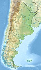
The El Carrizal Dam (in Spanish, Embalse El Carrizal) is a dam on the upper-middle course of the Tunuyán River, in the center-north of the province of Mendoza, Argentina upstream from the city of Rivadavia. Its reservoir measures about 15 by 5 kilometres (9.3 mi × 3.1 mi), and its maximum water level stands at 785.5 metres (2,577 ft) above the sea, covering an area of 34.8 square kilometres (13.4 sq mi). It has a maximum volume of 462 million cubic metres (16.3×10⁹ cu ft).[1]
The dam is used to regulate the flow of the Tunuyán River, which comes from glacial sources in the Andes, and to irrigate the otherwise arid region. The reservoir is a tourist attraction and is employed for fishing, windsurfing, sailing, etc., while its shores feature camping sites and other lodging facilities.
The waters of the dam feed a hydroelectric power station, which was built in 1971 and has an installed power generation capacity of 17 megawatts (23,000 hp).[1]
Notes
[edit]- ^ a b "Inventario de Presas y Centrales Hidroeléctricas de la República Argentina 2" (PDF). Ministerio de Planificación Federal, Inversión Pública y Servicios. Retrieved 2019-05-12.
References
[edit]External links
[edit] Media related to El Carrizal Dam at Wikimedia Commons

